UN
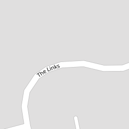
5 The Links
£ 250,000
Description
We don't have a Description for this property.
- Bedrooms
- 3
- Bathrooms
- 0


Leaflet © OpenStreetMap contributors
The heatmap indicates the level of crime in the area. The color of the heatmap indicates the crime severity and recency.
Metrics Year-on-Year
- Average area value
- 431,189.00 £Increased by 12.36 %
- Average area rental value
- 1,422.00 £/moIncreased by 14.03 %
- Est rental Yield
- 3.96 %Increased by 1.54 %
- Crime Rate
- 0.00 %
from 383,766.00 £
from 1,247.00 £/mo
from 3.90 %
from 0.00 %
Nearby Schools
| Name | Type | Ofsted | Distance |
|---|---|---|---|
| West St Leonards Primary Academy | Academy Sponsor Led | Good | 0.54 KM |
| Saxon Mount School | Academy Special Converter | Good | 0.71 KM |
| The St Leonards Academy | Academy Sponsor Led | Good | 0.79 KM |
| St Leonard'S Church Of England Primary Academy | Academy Sponsor Led | Good | 0.82 KM |
| Robsack Wood Primary Academy | Academy Converter | 1.65 KM |
Images
Nearby Streets
| Name | Average Price | Average Sqft | Distance |
|---|---|---|---|
| Regency Gardens | £ 0 | 0 | 0.00 KM |
| Summerhill | £ 660,000 | 0 | 0.00 KM |
| Crowhurst Road | £ 0 | 0 | 0.00 KM |
| Doucegrove | £ 310,000 | 0 | 0.00 KM |
| Cavendish Avenue | £ 480,000 | 0 | 0.00 KM |
Nearby Transport
| Name | NLC | TLC | Distance |
|---|---|---|---|
| West St Leonards | 5242 | WLD | 0.80 KM |
| St Leonards Warrior Square | 5239 | SLQ | 2.26 KM |
| Hastings | 5219 | HGS | 4.03 KM |
| Crowhurst | 5233 | CWU | 5.34 KM |
| Ore | 5021 | ORE | 5.71 KM |
Nearby Listings
| Address | Price | Type | Score | Distance |
|---|---|---|---|---|
| The Links, St. Leonards-On-Sea | £ 275,000 | BUY | 7 / 10 | 0.11 KM |
| Fern Road, St. Leonards-On-Sea | £ 345,000 | BUY | Unknown | 0.15 KM |
| Fern Road, St. Leonards-On-Sea | £ 370,000 | BUY | 7 / 10 | 0.17 KM |
| Wentworth Way, St. Leonards-On-Sea | £ 260,000 | BUY | 7 / 10 | 0.20 KM |
| Wentworth Way, St. Leonards-On-Sea TN38 0XG | £ 275,000 | BUY | Unknown | 0.23 KM |
Nearby Properties
| Address | Price | Distance |
|---|---|---|
| 21 The Links | £ 216,500 | 0.00 KM |
| 7 The Links | £ 205,000 | 0.00 KM |
| 5 The Links | £ 250,000 | 0.00 KM |
| 33 The Links | £ 197,000 | 0.00 KM |
| 1 The Drive | £ 285,000 | 0.05 KM |